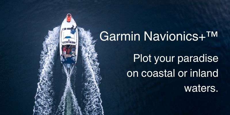
The world of marine navigation has evolved tremendously over the years, and a significant part of this evolution can be attributed to the advancement in marine electronics, particularly the development of sophisticated chartplotters. At the forefront of this innovation is Garmin, a brand synonymous with high-quality GPS chartplotter systems. Garmin’s integration of Navionics Maps has revolutionized marine navigation and fishing technology, providing boaters and anglers with unprecedented levels of detail and functionality. In this post, we delve into the Garmin Navionics+ and Garmin Navionics Vision+, exploring their key features, comparisons, subscription details, compatibility, and how to get started with these cutting-edge navigation tools.
Key Features of Navionics Charts for Garmin Chartplotters
Navionics mapping has become indispensable for mariners and fishing enthusiasts due to their detailed nautical charts, comprehensive coverage, and advanced features. Here’s why they are a game-changer in marine navigation:
- Detailed Nautical Charts: The essence of effective marine navigation lies in the accuracy and detail of the nautical charts used. Navionics charts provide meticulous details, ensuring that boaters have the most current and comprehensive data at their fingertips. This level of detail is crucial for safe navigation, avoiding hazards, and identifying key fishing areas.
- Coverage: With Navionics, users have access to an extensive range of coastal and inland content, encompassing over 44,000 lakes globally. This wide coverage ensures that whether you are cruising along coastlines or exploring inland waterways, you have reliable and detailed charts.
- Advanced Features: Navionics charts for Garmin chartplotters are packed with advanced features such as up to 1′ contours for precise detail, Auto Guidance+ Technology for optimal route planning, Depth Range Shading for easy identification of target depths, and Shallow Water Shading to highlight areas to avoid.
- Integration with ActiveCaptain App: The charts seamlessly integrate with the ActiveCaptain Apple app, providing daily updates and insights from the ActiveCaptain Google Play community. This integration enhances the user experience by ensuring that the charts are not only detailed but also current and enriched with community-sourced information.
Comparative Analysis: Garmin Navionics+ vs Garmin Navionics Vision+
When it comes to choosing between Garmin Navionics+ and Garmin Navionics Vision+, it’s essential to understand their differences:
- Garmin Navionics+ Card offers comprehensive chart coverage with detailed nautical charts and advanced features. It’s an excellent choice for standard navigation and fishing needs.
- Garmin Navionics Vision+, on the other hand, takes it a notch higher. It includes all the features of Navionics+ and adds special enhancements like 3D views for a more realistic representation of the underwater world and high-resolution shading for better terrain differentiation.
Both versions offer exceptional value, but the choice ultimately depends on the specific needs and preferences of the user.
Subscription and Compatibility
Navionics charts operate on a subscription model, which includes the first year of updates. After the first year, users can opt to continue their subscription to receive ongoing updates. This model ensures that boaters always have the latest and most accurate chart data.
Compatibility is key when using Navionics charts with Garmin chartplotters. It’s important to ensure that your Garmin device is compatible with Navionics software to fully utilize its features and capabilities.
How to Get Started
Getting started with Navionics charts on your Garmin chartplotter involves a few simple steps:
- Purchase and Activate Subscription: Choose between Garmin Navionics+ or Garmin Navionics Vision+ based on your needs and purchase the subscription.
- Download and Install Updates: Follow the guide to download and install updates on your chartplotter. This process is straightforward and ensures that you have the latest chart data.
Why Garmin Navionics Charts Enhance Your Boating Experience
The integration of Navionics charts into Garmin chartplotters represents a significant leap in marine navigation and fishing technology. These charts provide detailed, comprehensive, and up-to-date navigation data, ensuring safety and efficiency on the water. Whether you’re a professional mariner, an avid angler, or a recreational boater, the Garmin Navionics Charts are an indispensable tool.
Located in Stuart, Florida, J-TEK Marine Electronics is proud to offer decades of experience in cutting-edge electronic installation, repairs, and retrofits. Our dedicated team specializes in the expert installation of marine electronics, aimed at elevating and simplifying your boating adventures. Contact us today to explore how Garmin marine solutions can maximize your enjoyment on the water.